Services
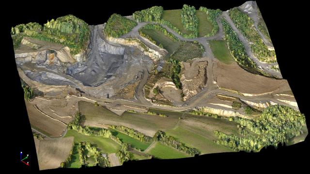
3D Mapping
Mapping with drones is done using technique called photogrammetry-science of making measurements from photographs. The output of this is a 3D model of a real world object or scene. Drones are deployed with ultra high resolution optical sensors to acquire multiple overlapping photos of the ground following a predefined flight path.
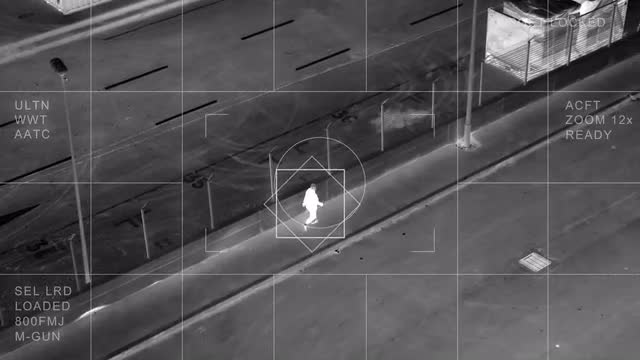
Surveillance
Our UAV’s are ready whether you’re monitoring a large event, a protest, or even an individual, our aerial vehicles can provide your team with the overview they need to maintain control. Our UAV monitoring systems provide a number of benefits to users focused on public safety and civil security: long flight times mean fewer pauses for battery changes and more monitoring. Real-time monitoring and coordination, Tough in rough weather & Payload flexibility.
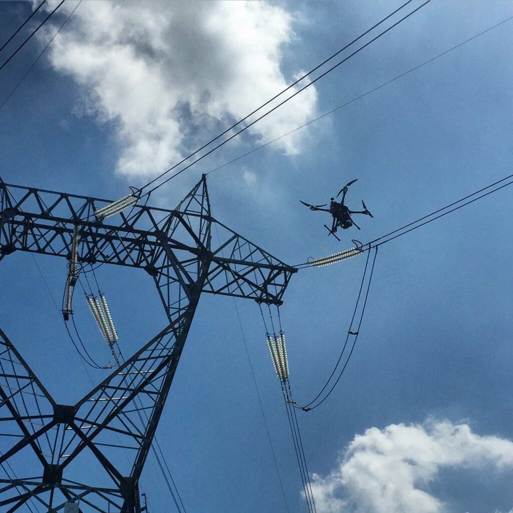
Survey
Drone surveys are a faster, safer and more efficient way to survey at height and an increasingly popular method of surveying from the air. Drones can be deployed rapidly and allow asset managers to interrogate defects using ultra high definition 4K imaging. Our drones frequently provide fresh data on previously difficult to see areas helping the user to make quicker and assured decisions.
Thermal Surveys / Indoor Surveys / Condition & Roof Survey / Topographical Survey / Telecom Site Surveys / Overhead Power-line Survey / Volumetric
Monitoring
Our flying platforms offer continuous and real-time aerial traffic monitoring, allowing persistent data collection and analysis. A tethered drone is a compact tool which is easy to transport and deploy. This gives access to various valuable traffic data (trajectories, behaviors & vehicle types), which is crucial information for transport operators and public authorities.
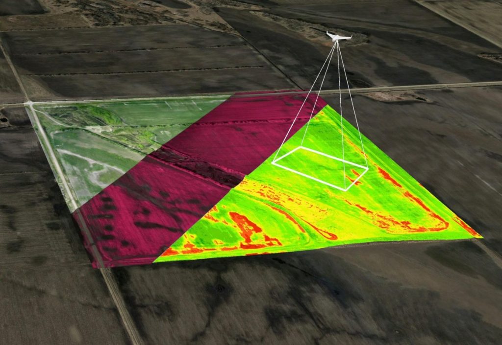
Agriculture
Precision agriculture is a farming management concept based on observing, measuring, and responding to inter & intra-field variability in crops. The farmer’s and/or researcher’s ability to locate a precise position in a field lets him create maps of the spatial variability of as many variables as can be measured (e.g. crop yield, terrain features/topography, organic matter content, moisture levels, nitrogen levels, pH, etc.). Precision agriculture has been enabled by technologies like: crop yield monitors mounted on GPS-equipped combines; variable rate technology (VRT) like seeders, sprayers, etc,; an array of real-time vehicle mountable sensors that measure everything from chlorophyll levels to plant water status; and multi- and hyper-spectral aerial and satellite imagery, from which products like Normalized Difference Vegetation Index (NDVI) maps are made.
Inspection